Font size too small?   Increase Font size | Decrease font size | See other Accessibility Options.
Index Banded Annual Totals for Swansea:
LOW
100 days
MODERATE
10 days
HIGH
1 day
VERY HIGH
4 days

Graphs

If you are requesting data (in any format i.e. csv or pdf) please ensure that info.swansea.airqualitydata.com is added to your email systems "whitelist". If not, you may find that the emails are either not delivered or placed in your "junk" or "spam" folders

To see a specific graph please specify the parameters to the right.
Please select either Air Quality data or Meterological data.

Alternatively see the Current Readings page for today's measurements.

For more information about air quality in the rest of the UK please see the Air Index Archive

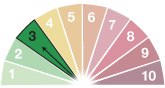
To see the Banded Graphs click here.

Please note: the scales on the graphs are fixed.

Please note all data is displayed as Greenwich Mean Time (GMT)

All data are displayed as an hourly average unless you have selected
a 24 hour period or less where the average shown will by a 15 minute average.
The data supplied are non-validated and for information only.

Generate a Graph:

Select a monitoring station

You are able to view more than one substance for multiple sites, with an overall maximum of six substances per graph.

 
30m Mast  - Cwm Level Park
 
Cwm Level Park Ozone and NOx
 
Hafod OPSIS DOAS
 
Morriston Groundhog
 
St Thomas DOAS
 
Swansea AURN
 
Swansea Bay
 

Colour coding: Each station is represented by a colour (see the squares next to each station name). To see which station monitors which substance see the coloured squares under each pollutant.

Air Quality data
 NOx  
Morfa Groundhoggraphic used for layoutMorriston Groundhoggraphic used for layoutSwansea AURNgraphic used for layoutCwm Level Park Ozone and NOxgraphic used for layout
 NO  
Morfa Groundhoggraphic used for layoutMorriston Groundhoggraphic used for layoutSwansea AURNgraphic used for layoutHafod OPSIS DOASgraphic used for layoutCwm Level Park Ozone and NOxgraphic used for layout
 NO2  
Morfa Groundhoggraphic used for layoutMorriston Groundhoggraphic used for layoutSwansea AURNgraphic used for layoutHafod OPSIS DOASgraphic used for layoutSt Thomas DOASgraphic used for layoutCwm Level Park Ozone and NOxgraphic used for layout
 SO2  
St Thomas DOASgraphic used for layout
 H2S  
 CO  
 O3  
Morriston Groundhoggraphic used for layoutHafod OPSIS DOASgraphic used for layoutSt Thomas DOASgraphic used for layoutCwm Level Park Ozone and NOxgraphic used for layout
 PM10  
Morfa Groundhoggraphic used for layoutSwansea AURNgraphic used for layout
 PM2.5  
Morriston Groundhoggraphic used for layoutSwansea AURNgraphic used for layout
 Benzene  
Hafod OPSIS DOASgraphic used for layoutSt Thomas DOASgraphic used for layout
 Toluene  
 Xylene  
Meteorological data
 Wind Speed  
OPSIS Guildhall Meteorological Stationgraphic used for layoutMorriston Groundhoggraphic used for layoutSwansea Baygraphic used for layout
 Wind Direction  
OPSIS Guildhall Meteorological Stationgraphic used for layoutMorriston Groundhoggraphic used for layoutSwansea Baygraphic used for layout
 Wind Speed at 1Om  
30m Mast  - Cwm Level Parkgraphic used for layout
 Wind Direction at 10m  
30m Mast  - Cwm Level Parkgraphic used for layout
 Wind Speed at 3Om  
30m Mast  - Cwm Level Parkgraphic used for layout
 Wind Direction at 30m  
30m Mast  - Cwm Level Parkgraphic used for layout
 Wind Speed 5m above roof ridge level  
Hafod Street Canyon Meteorological Monitoring Stationgraphic used for layout
 Wind Direction 5m above roof ridge level  
Hafod Street Canyon Meteorological Monitoring Stationgraphic used for layout
 Horizontal Wind Speed at first floor level  
Hafod Street Canyon Meteorological Monitoring Stationgraphic used for layout
 Horizontal Wind Direction at first floor level  
Hafod Street Canyon Meteorological Monitoring Stationgraphic used for layout
 Vertical Wind Speed at first floor level  
Hafod Street Canyon Meteorological Monitoring Stationgraphic used for layout
 Air Temperature  
Morfa Groundhoggraphic used for layoutOPSIS Guildhall Meteorological Stationgraphic used for layoutMorriston Groundhoggraphic used for layoutSwansea Baygraphic used for layout
 8-2m Differential Temperature  
30m Mast  - Cwm Level Parkgraphic used for layout
 22-8m Differential Temperature  
30m Mast  - Cwm Level Parkgraphic used for layout
 2m Absolute Temperature  
30m Mast  - Cwm Level Parkgraphic used for layout
 2m Differential Temperature  
 Air Temperature at first floor level  
Hafod Street Canyon Meteorological Monitoring Stationgraphic used for layout
 2m Relative Humidity  
30m Mast  - Cwm Level Parkgraphic used for layout
 Relative Humidity at first floor level  
Hafod Street Canyon Meteorological Monitoring Stationgraphic used for layout
 Barometric Pressure  
OPSIS Guildhall Meteorological Stationgraphic used for layoutSwansea Baygraphic used for layout
 Global Radiation  
OPSIS Guildhall Meteorological Stationgraphic used for layoutHafod Street Canyon Meteorological Monitoring Stationgraphic used for layoutSwansea Baygraphic used for layout
 Global Radiation at 30m  
30m Mast  - Cwm Level Parkgraphic used for layout
 Global Reflected Radiation  
OPSIS Guildhall Meteorological Stationgraphic used for layout
 Terrestial Radiation  
OPSIS Guildhall Meteorological Stationgraphic used for layout
 Rainfall  
OPSIS Guildhall Meteorological Stationgraphic used for layout30m Mast  - Cwm Level Parkgraphic used for layoutSwansea Baygraphic used for layout
 UV(A)  
OPSIS Guildhall Meteorological Stationgraphic used for layoutSwansea Baygraphic used for layout
 UV(B)  
OPSIS Guildhall Meteorological Stationgraphic used for layoutSwansea Baygraphic used for layout
 UV(I)  
Swansea Baygraphic used for layout
Select time / date period
From:
To:

Please be aware that graphs can take a few moments to display, please be patient while we retrieve your required data